-Required for one of the most reputable Surveying & Mapping Services companies in Saudi Arabia and the region:
فرص عمل لدى كبرى شركات خدمات الخرائط و المساحة في المملكة العربية السعودية و المنطقة:-
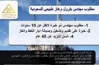
1. RESIDENT PROJECT MANAGER
Qualifications:
Ø The Resident Project Manager shall be a professional registered land surveyor.
Ø M.S. degree in surveying engineering or equivalent.
Ø Minimum of 15 years proven practical experience in managing similar jobs.
2. SURVEY SUPERVISORS (Field Operations/Office Operations)
Qualifications:
Ø Shall be a professional registered land surveyor.
Ø University degree in surveying engineering or equivalent.
Ø Minimum of 8 years proven practical experience as a supervising surveyor in similar projects.
3. CHIEF HYDROGRAPHIC SURVEYOR
Qualifications:
Ø Degree in Surveying or Geomatic Engineering or equivalent
Ø Minimum of 8 years proven practical experience as a full charge hydrographic party chief experienced with hydrographic survey systems, equipment and applications.
Ø Minimum of 3 years land surveying experience.
4. SURVEY CREW CHIEF
Qualifications:
Ø Associates in applied science in Geomatic/Surveying Technology or equivalent.
Ø Minimum of 8 years proven practical experience as a full charge survey crew chief.
Ø Minimum of 3 years' experience with real time kinematic (RTK) and static GPS surveys.
5. CAD OPERATORS
Qualifications:
Ø Associates in applied science degree in Geomatic/Surveying technology.
Ø Minimum of 6 years proven practical experience in survey data processing and the production of topographic, subdivision, cadastral and hydrographic maps using CADD and professional surveying applications.
Ø Minimum of 3 years' experience with real time kinematic (RTK) and static GPS surveys data processing.
6. GIS DATA ANALYST
Qualifications:
Ø University degree, preferably in GIS, computer science or relevant fields
Ø Minimum of 5 years practical experience as GIS Data Analyst
7. GIS DATA SPECIALIST
Qualifications:
Ø University degree, preferably in GIS, computer science, or relevant fields
Ø Minimum 5 years of progressively advanced work experience in use of GIS databases or related software for environmental projects
8. GIS MAPPING TECHNICIAN
Qualifications:
Ø Associates in applied science degree in Geomatic/Surveying technology.
Ø Minimum of 6 years proven practical experience working with ESRI ArcGIS.
Ø Minimum of 3 years' experience with real time kinematic (RTK) and static GPS surveys data processing.
9. HYDROGRAPHIC SURVEY TECHNICIAN
Qualifications:
Ø A degree/Diploma in land surveying or civil engineering
Ø Minimum of 6 years proven practical experience as an instrument Operator/chainman (Rodman).
Ø Minimum of 3 years' experience with real time kinematic (RTK) and static GPS surveys.
10. DOCUMENT CONTROLLER
Qualifications:
Ø Vocational Diploma/Certificate from a 2 year Technical course
Ø At least 3 years related work experience in office work, documentation and control
Apply.career.gcc@gmail.com
| مدة الاعلان | : شهر |
| الدولة | : مصر |
| المدينة | : القاهرة |
عفوا! هذا الاعلان منتهى الصلاحية. | |
 أنت فى مصر (القاهرة)